

Colorado’s Gold Mountain Fire: How to Track Evacuations Fast
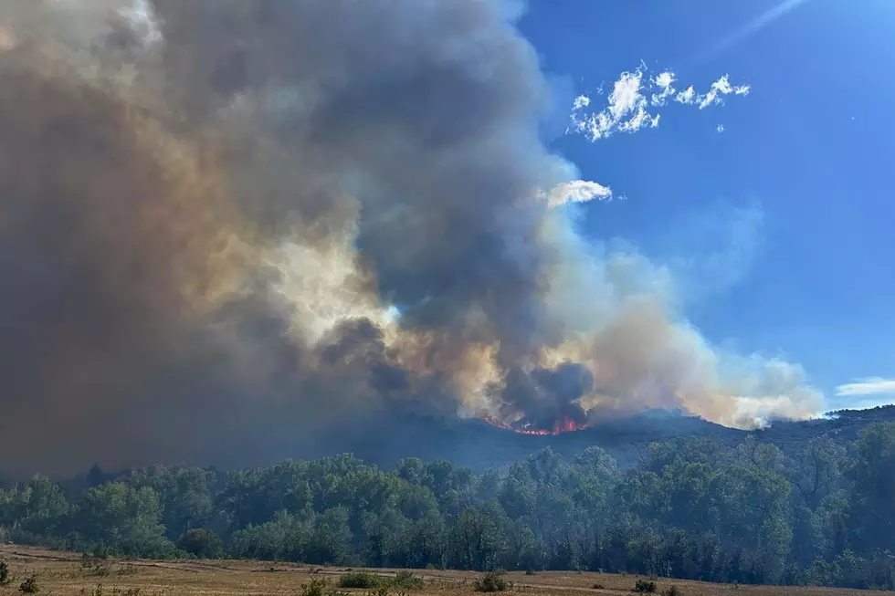
Colorado’s Gold Mountain Fire remained active over the weekend. There was growth on the northeastern flank of the fire near Nate Creek, and in areas near the West Fork of the Cimarron River. The most recent update reports the fire at 37,800 acres, at 13% containment.
The fire has threatened residents in Ouray, Gunnison, Montrose, and Hinsdale Counties since late June. Teams continue to strengthen containment lines along U.S. 550 and County Road 12. This week will be another hectic one for both firefighters and residents, meaning there will be numerous updates to keep track of.

How Much of the Cimarron Ridge Is In Danger? Here's What We Know
Read More: What Colorado's Fire Restriction Stages Really Mean
There’s no doubt the spectacular terrain of the Cimarron Valley is some of the prettiest ground in Colorado. The Gold Mountain Fire is advancing in the areas of Cimarron Ridge, Owl Creek Pass, and Cow Creek. The following terrain is being impacted by smoke, active fire nearby, and extensive U.S. Forest Service closures.
- Owl Creek Pass: The pass and Deb's Meadow are heavily threatened and experiencing active fire behavior and strategic burnout operations nearby. The landmark itself is not destroyed.
- Silver Jack Reservoir: Fire crews are defending the reservoir area and nearby subdivisions (like Silver Jack and Bear Claw) from the advancing northeast run of the fire.
- Cimarron Ridge & Cow Creek: These dramatic high-country hiking and drainage areas have experienced significant fire progression and heavy active burning.
Plane Down at Silver Jack Reservoir
Authorities in Gunnison County announced about 8 PM Sunday (July 12) that a plane involved in firefighting operations had gone down in or near Silver Jack Reservoir. Montrose County Sheriff's Office dive team assisted. The incident appears to have occurred around 5:17 P.M. Denver7.com reports the pilot died as a result of the crash.
These County Hotlines Can Save You Valuable Time

Read More: What Colorado's Fire Restriction Stages Really Mean
For information on evacuations and road closures for counties impacted by the Gold Mountain Fire, the following numbers are available to provide information.
- Ouray County Evacuation Hotline at 970-626-5484.
- Gunnison County Emergency Hotline at 970-641-7660.
- Montrose County Emergency Hotline at 970-252-4545.
- Hinsdale County Emergency Management at 970-944-225.
- Gold Mountain Fire Hotline: 970-355-3286.
- See Grand Mesa, Gunnison, and Uncompahgre National Forest Closures here.
- See BLM Uncompahgre Field Office Closures here.
Download These Apps Before You Need Them

Read More: Colorado's Highways Are a Bigger Fire Threat Than You Think
Our station app sends local information from our local DJs and content creators here on the Western Slope. Allow notifications for our Gold Mountain Fire updates.
- Watch Duty delivers wildfire maps, evacuation notices, and firefighter updates.
- COTrip real-time highway closures, traffic cameras, and travel alerts.
- The FEMA App adds weather alerts and preparedness resources.
LOOK: See Photos of the Gold Mountain Fire Near Ouray, Colorado
Gallery Credit: Wesley Adams
UP NEXT: See Stunning Photos of Colorado's Snyder Mesa Fire
Gallery Credit: Wesley Adams
MORE: It's Easy To See Why Colorado Loves the Maroon Bells
Gallery Credit: Wesley Adams
More From 95 Rock

